
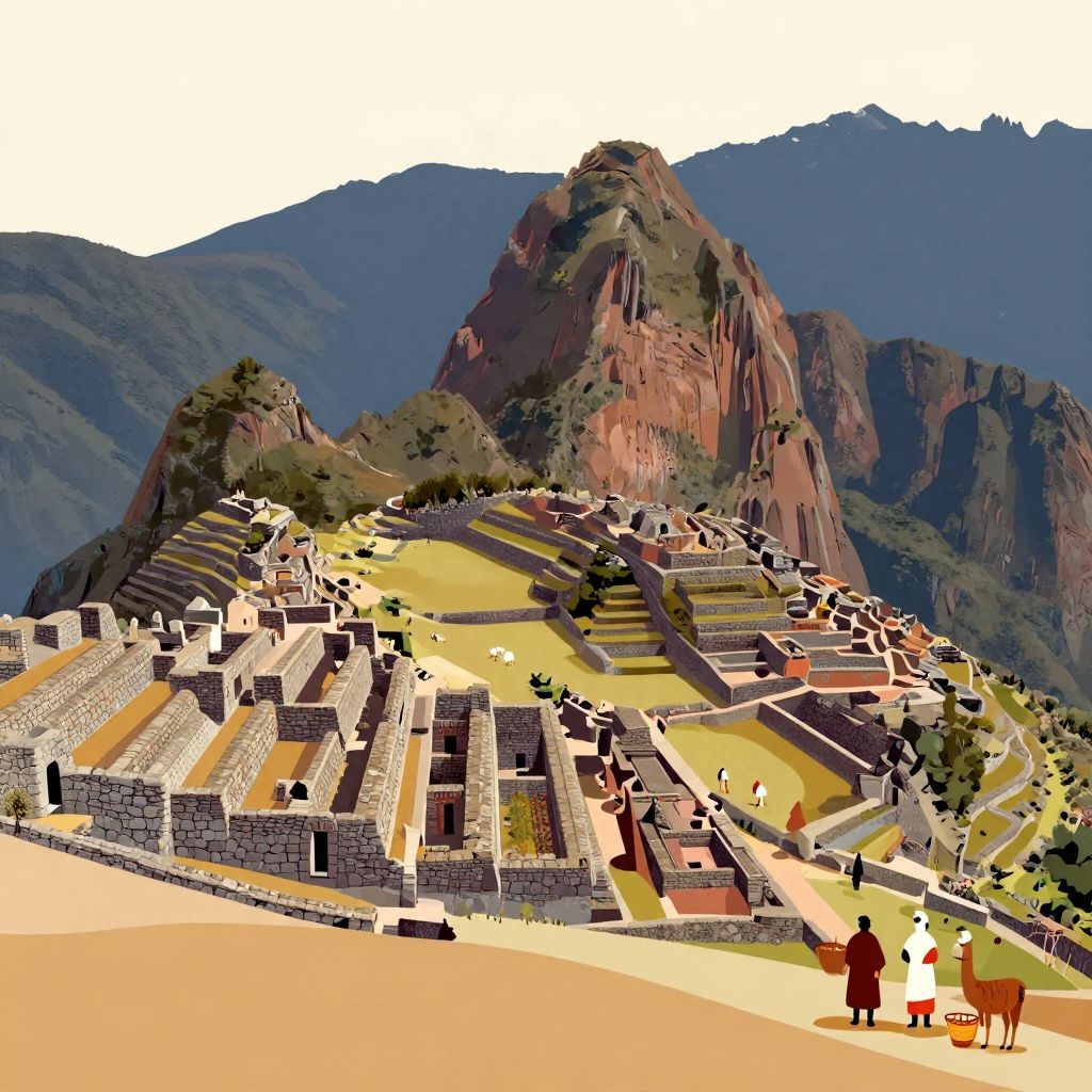
Where did the Incas live? The short answer is that the Incas lived in the Andes of western South America, especially in and around present-day Peru. Their empire, known as Tawantinsuyu, eventually stretched far beyond the city of Cusco into parts of modern Ecuador, Bolivia, Chile, Argentina, and Colombia.
But the Incas were not a single tribe living in one place forever. They began as a regional people in the highlands of Peru and, over time, built one of the largest states in the pre-Columbian Americas. Their homes, roads, farms, and cities were shaped by steep mountains, dry valleys, and a remarkably diverse landscape.
Where did the Incas live?
The Incas lived primarily in the Andean highlands of South America, with their political center at Cusco in present-day Peru. From there, they expanded across a vast mountain empire that included coastal deserts, high plateaus, and tropical valleys. Their heartland was in the central Andes, not the Amazon lowlands or the Caribbean.
The Inca homeland: Cusco and the central Andes
The Incas emerged in the region around Cusco, a high-altitude city in southeastern Peru. According to Inca tradition, Cusco was their sacred center and the place from which their rulers governed. Archaeology and history suggest that the Inca state developed there in the 15th century, growing from a local kingdom into an empire.
Why Cusco mattered
Cusco was important because it sat in a strategic Andean corridor. The surrounding valleys supported farming, while nearby mountain routes connected different ecological zones. This allowed the Incas to control trade, labor, and military movement. Cusco was also a ceremonial center, reinforcing the ruler’s authority through religion and ritual.
The landscape of Inca life
Life in the Andes required adaptation to altitude, cold nights, and uneven terrain. The Incas built terraces on mountain slopes, irrigation systems, and stone roads to make the land productive and navigable. Their settlements were often placed where different environments met, so they could grow crops, raise animals, and access a variety of resources.
How far did Inca territory extend?
At its height in the early 16th century, the Inca Empire stretched along much of the western edge of South America, from southern Colombia through Ecuador and Peru into Bolivia, northern Chile, and northwestern Argentina. This was not a single continuous “country” in the modern sense, but a network of provinces linked by roads, administration, and tribute.
Major regions within the empire
- Peru — the core of Inca political power and the location of Cusco.
- Bolivia — including highland areas around Lake Titicaca.
- Ecuador — incorporated during later expansion northward.
- Chile — especially the northern regions.
- Argentina — parts of the northwest came under Inca control.
- Colombia — the far northern reach was limited and less firmly controlled than the core provinces.
The empire’s borders were not always fixed. Control varied by region, and some areas were more tightly governed than others. In frontier zones, Inca authority could be military, administrative, or symbolic rather than fully direct.
What kind of places did the Incas build?
The Incas lived in a wide range of settlements, from royal estates and provincial centers to farming communities and mountain shrines. Their architecture is famous for carefully fitted stone walls, but not every Inca building was monumental. Many people lived in practical homes made from stone, adobe, or a combination of materials depending on local conditions.
Cusco as an imperial capital
Cusco was the main political and ceremonial center. It housed nobles, administrators, priests, and craftsmen who served the state. The city was organized in relation to Inca social and religious ideas, including divisions that reflected status and lineage. It was both a living city and a symbol of imperial order.
Machu Picchu and other mountain sites
Sites such as Machu Picchu show how the Incas used dramatic mountain settings for elite residences, ritual spaces, and agricultural terraces. Machu Picchu was not the empire’s capital, as is sometimes mistakenly claimed, but rather a royal estate or ceremonial center associated with Inca rulers. Its location reflects the Inca preference for places with strong symbolic and strategic value.
Provincial centers and road stations
As the empire expanded, the Incas founded or reorganized provincial centers. These sites helped collect tribute, store food, and oversee labor. Along the famous Inca road system, they also built way stations and storage facilities to support messengers, armies, and officials. In this way, Inca settlement was tied closely to administration and movement.
How did geography shape Inca living patterns?
The Andes are one of the most challenging environments in the world, but the Incas turned that challenge into an advantage. Rather than relying on a single type of land, they used multiple ecological zones at different elevations. This strategy helped them obtain maize, potatoes, quinoa, camelid wool, and other essential resources.
The “vertical archipelago” idea
Historians often use the phrase vertical archipelago to describe how Andean societies, including the Incas, managed land across different heights. Communities maintained access to fields in several ecological zones so they could produce a range of goods. This was not a literal archipelago of islands, but a useful way to explain how mountain peoples connected scattered resources.
Terraces, roads, and storage
To live in the Andes, the Incas engineered the landscape. Terraces reduced erosion and created flat planting surfaces. Roads crossed mountains and valleys, linking towns and military posts. Storehouses held surplus food for emergencies, festivals, and state use. These systems made it possible for a large empire to function in difficult terrain.
Did all Incas live in the same way?
No. “The Incas” can mean both the ruling elite and the broader population of the empire. The emperor and nobles lived differently from farmers, herders, artisans, and laborers. Social rank shaped housing, food, clothing, and access to land. Even within the empire, local customs often continued under Inca rule.
Elite life
Inca rulers and nobles lived in palaces, estates, and ceremonial compounds. They wore distinctive clothing, participated in ritual feasts, and controlled labor and tribute. Their residences were often located in or near political centers and sacred landscapes, emphasizing authority and divine legitimacy.
Commoner life
Most people lived in rural communities and worked the land. Families farmed terraces, raised llamas and alpacas, and contributed labor to state projects. Inca rule did not erase local identities; instead, it often incorporated existing communities into a larger administrative system. Many people continued speaking local languages and practicing regional traditions alongside Inca customs.
How did the Incas expand from one region to an empire?
The Incas began as a local power in the Cusco region and expanded through diplomacy, alliance, resettlement, and military conquest. Their rise accelerated during the reigns of rulers such as Pachacuti in the 15th century. Expansion brought new lands, but it also created the need for roads, governors, and labor systems to hold the empire together.
From local kingdom to imperial state
Early Inca rulers were one among several regional powers in the Andes. Over time, they defeated rivals and absorbed neighboring groups. The state then reorganized conquered territories into provinces, often preserving local elites while placing them under Inca supervision. This flexible system helped the empire grow quickly.
Why expansion changed where Incas lived
As the empire expanded, Inca officials, soldiers, and settlers moved into new regions. Some communities were relocated by the state, a policy often called mitmaq or mitma. These relocations helped secure frontier zones, spread imperial influence, and manage labor. So while Cusco remained the center, Inca presence became widespread across the Andes.
What happened to Inca settlements after the Spanish conquest?
After the Spanish arrived in the 1530s, Inca political power collapsed, but Inca communities did not disappear. Many people remained in their ancestral regions, adapted to colonial rule, and continued to live in Andean highland villages. Some Inca sites were abandoned, while others were reused or transformed by the Spanish.
Continuity and change
The conquest disrupted imperial administration, but it did not erase Inca culture. Quechua-speaking communities persisted across the Andes, and many traditions survived in altered form. The modern descendants of Inca subjects still live throughout Peru and neighboring countries, especially in highland regions where Andean lifeways remain visible.
So, where did the Incas live in historical terms?
Historically, the Incas lived in the Andes, centered on Cusco in present-day Peru, and later across a large empire spanning much of western South America. They lived in mountain cities, rural villages, royal estates, and administrative centers adapted to steep terrain and varied climates. Their world was shaped by altitude, engineering, and imperial expansion.
Understanding where the Incas lived means seeing more than a map. It means recognizing how they turned the Andes into a connected imperial landscape. If you want to explore more, you can also read about what language the Incas spoke and what Machu Picchu means.